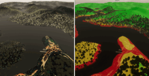
This study assesses the visualization of the impact of floods resulting from dam peak discharges. We explore the challenges and possibilities of using dam safety control proxsituated environments for analyzing data in a domain other than the structural. We propose a virtual reality application that allows users to fly above the terrain located downstream of the Cabril Dam and visualize which areas present the most significant risk of being flooded in the event of dam peak discharges. It also allows the visualization of the impact of floods in urban areas for each individual building.
 Back to Research